Log in
All resources
Create a design
4,035 Free Images of World Map
national library of poland
atlas ou representation du monde universel t. 2 (1633)
maps by hendrik hondius the younger
bibliothèque nationale de france
history
historical
maps
a short history of the world
cartography
planet
tropical
maps
atlas, ou représentation du monde universel et des parties d'icelui, faicte en tables et descriptions très amples et exactes, divisé en deux tomes. édition nouvelle... - btv1b53103889w
maps of candia by ortelius and mercator
mappe-monde geo-hydrographique (sanson and jaillot, 1674)
louis cordier
atlas, ou représentation du monde universel et des parties d'icelui, faicte en tables et descriptions très amples et exactes, divisé en deux tomes. édition nouvelle... - btv1b53103889w
17th-century maps of chile
atlas, ou représentation du monde universel et des parties d'icelui, faicte en tables et descriptions très amples et exactes, divisé en deux tomes. édition nouvelle... - btv1b53103889w
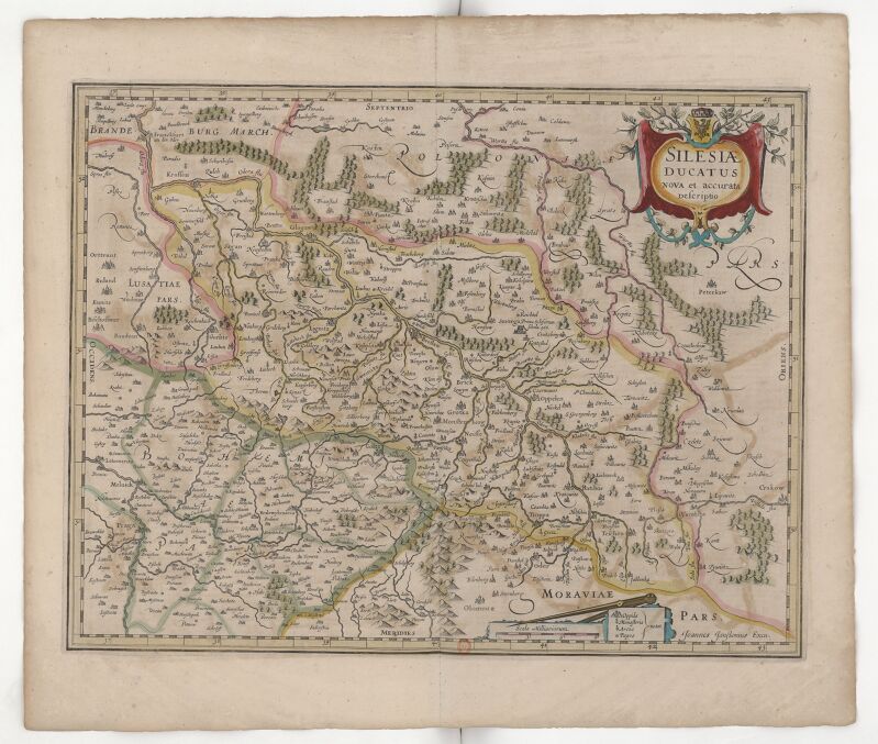
17th-century maps of silesia
atlas, ou représentation du monde universel et des parties d'icelui, faicte en tables et descriptions très amples et exactes, divisé en deux tomes. édition nouvelle... - btv1b53103889w
maps of the peloponnese by gerardus mercator
maps of the south atlantic
guillaume dheulland
historical
history
historical
history
historical
history
planet
maps
images from the tango project
tango project
atlas ou representation du monde universel t. 1 (1633)
maps by hendrik hondius the younger
atlas ou representation du monde universel t. 1 (1633)
maps by hendrik hondius the younger
atlas ou representation du monde universel t. 1 (1633)
maps of england by gerardus mercator
sao tome and principe
map
17th-century maps of the mediterranean sea
1610 maps of europe
theatrum orbis terrarum (1606 bodleian)
maps of wales by humphrey llwyd
imperial war museum first world war artwork
émile eugène belin
nicolas sanson. “mappe-monde, ou carte generale du monde.”
map of the bosphorus strait by guillaume sanson (1665)
nicolas sanson. “mappe-monde, ou carte generale du monde.”
1667 map of madagascar by guillaume sanson
wanderings, south and east (1882)
1882 maps of the world
maps of frankfurt (oder) by braun & hogenberg
maps in cosmographia (münster)
maps of frankfurt (oder) by braun & hogenberg
maps in cosmographia (münster)
carte de la moldavie pour servir à l'histoire militaire de la guerre entre les russes et les turcs - levés par l'etat-major sous la direction de f.g. de bawz... echelle de 10 heures de moldavie, 50... - btv1b53100577d
leonard schenk jansz.
prints by oluf olufsen bagge in the statens museum for kunst
etching and copper engraving
planet
maps
carte de la moldavie pour servir à l'histoire militaire de la guerre entre les russes et les turcs - levés par l'etat-major sous la direction de f.g. de bawz... echelle de 10 heures de moldavie, 50... - btv1b53100577d
leonard schenk jansz.
carte de la moldavie pour servir à l'histoire militaire de la guerre entre les russes et les turcs - levés par l'etat-major sous la direction de f.g. de bawz... echelle de 10 heures de moldavie, 50... - btv1b53100577d
leonard schenk jansz.
carte de la moldavie pour servir à l'histoire militaire de la guerre entre les russes et les turcs - levés par l'etat-major sous la direction de f.g. de bawz... echelle de 10 heures de moldavie, 50... - btv1b53100577d
leonard schenk jansz.
for your interface (free samples) pack
network
carte de la moldavie pour servir à l'histoire militaire de la guerre entre les russes et les turcs - levés par l'etat-major sous la direction de f.g. de bawz... echelle de 10 heures de moldavie, 50... - btv1b53100577d
leonard schenk jansz.
carte de la moldavie pour servir à l'histoire militaire de la guerre entre les russes et les turcs - levés par l'etat-major sous la direction de f.g. de bawz... echelle de 10 heures de moldavie, 50... - btv1b53100577d
leonard schenk jansz.
maps by alexis-hubert jaillot
sanson maps of the holy land
illustration
maps
bibliothèque nationale de france
guillaume sanson
illustration
maps
atlas ou representation du monde universel t. 2 (1633)
1630s maps of lower saxony
context files from gallica
pieter van der keere
historical
history
historical
history
mappe-monde geo-hydrographique (sanson and jaillot, 1674)
cartography of france
historical
history
historical
history
historical
history
historical
history
historical
history
atlas ou representation du monde universel t. 2 (1633)
maps by hendrik hondius the younger
atlas sive cosmographicae (gerardus mercator, 1607)
maps of liège by baptista van doetecum
background
maps
still-life paintings of musical instruments
bartolomeo bettera
papua new guinea
map
symbol
maps
atlas ou representation du monde universel t. 2 (1633)
old maps of groningen (province)
atlas ou representation du monde universel t. 2 (1633)
1633 maps of africa
atlas ou representation du monde universel t. 2 (1633)
maps of the duchy of montferrat
atlas ou representation du monde universel t. 2 (1633)
maps by hendrik hondius the younger
atlas ou representation du monde universel t. 2 (1633)
17th-century maps of italy
atlas ou representation du monde universel t. 2 (1633)
maps by hendrik hondius the younger
atlas ou representation du monde universel t. 2 (1633)
maps by jan janssonius
atlas ou representation du monde universel t. 2 (1633)
maps of the county of mansfeld
atlas ou representation du monde universel t. 2 (1633)
old maps of nassau
atlas ou representation du monde universel t. 2 (1633)
maps of vicenza
atlas ou representation du monde universel t. 2 (1633)
17th-century maps of chile
atlas ou representation du monde universel t. 2 (1633)
17th-century maps of silesia
atlas ou representation du monde universel t. 2 (1633)
maps by hendrik hondius the younger
atlas ou representation du monde universel t. 2 (1633)
maps by jan janssonius
atlas ou representation du monde universel t. 2 (1633)
maps by hendrik hondius the younger
atlas ou representation du monde universel t. 2 (1633)
1633 maps of asia
atlas ou representation du monde universel t. 2 (1633)
maps by hendrik hondius the younger
atlas ou representation du monde universel t. 2 (1633)
maps by hendrik hondius the younger
atlas ou representation du monde universel t. 2 (1633)
maps by hendrik hondius the younger
atlas ou representation du monde universel t. 2 (1633)
old maps of east frisia
atlas ou representation du monde universel t. 2 (1633)
maps by hendrik hondius the younger
atlas ou representation du monde universel t. 2 (1633)
maps of the duchy of milan
atlas ou representation du monde universel t. 2 (1633)
maps of the duchy of mantua
atlas ou representation du monde universel t. 2 (1633)
1633 maps of africa
atlas ou representation du monde universel t. 2 (1633)
maps by hendrik hondius the younger
maps of brazil by hendrik hondius
bibliothèque nationale de france
world war i postcards of german empire
photographs by e. bieber
atlas ou representation du monde universel t. 2 (1633)
maps of sardinia by gerardus mercator
atlas ou representation du monde universel t. 2 (1633)
maps by hendrik hondius the younger
atlas ou representation du monde universel t. 2 (1633)
maps by hendrik hondius the younger
atlas ou representation du monde universel t. 2 (1633)
maps by hendrik hondius the younger
atlas ou representation du monde universel t. 2 (1633)
17th-century maps of peru
atlas ou representation du monde universel t. 2 (1633)
17th-century maps of bermuda
atlas ou representation du monde universel t. 2 (1633)
17th-century maps of paraguay
building
maps
battles of lexington and concord
amos doolittle
bibliothèque nationale de france
hendrik de leth
historical
history
illustration
maps
illustration
maps
historical
history
historical
history
illustration
maps
maps of the arctic by gerardus mercator
maps by hendrik hondius the younger
scenes from every land, second series (1909)
photographs by arnold henry savage landor
maps of brazil by hendrik hondius
bibliothèque nationale de france
3401 - 3500 of 4,035
Next page
/ 41


![Gerardi Mercatoris and I. Hondii Atlas or Representation of the Universal World, and of the Parts of It, Made in Tables and Descriptions Very Ample, and Exact: Divided into Two Volumes [...]. [t. 1].](https://cdn.creazilla.com/illustrations/10000604152/gerardi-mercatoris-and-i-hondii-atlas-or-representation-of-the-universal-world-and-of-the-parts-of-it-made-in-tables-and-descriptions-very-ample-and-exact-divided-into-two-volumes-t-1-sm.webp)
![Gerardi Mercatoris and I. Hondii Atlas or Representation of the Universal World, and of the Parts of It, Made in Tables and Descriptions Very Ample, and Exact: Divided into Two Volumes [...]. [t. 1].](https://cdn.creazilla.com/illustrations/10001462413/gerardi-mercatoris-and-i-hondii-atlas-or-representation-of-the-universal-world-and-of-the-parts-of-it-made-in-tables-and-descriptions-very-ample-and-exact-divided-into-two-volumes-t-1-md.jpg)
![Gerardi Mercatoris and I. Hondii Atlas or Representation of the Universal World, and of the Parts of It, Made in Tables and Descriptions Very Ample, and Exact: Divided into Two Volumes [...]. [t. 1].](https://cdn.creazilla.com/illustrations/10000720637/gerardi-mercatoris-and-i-hondii-atlas-or-representation-of-the-universal-world-and-of-the-parts-of-it-made-in-tables-and-descriptions-very-ample-and-exact-divided-into-two-volumes-t-1-sm.webp)


![Gerardi Mercatoris and I. Hondii Atlas or Representation of the Universal World, and of the Parts of It, Made in Tables and Very Ample Descriptions. [t. 2].](https://cdn.creazilla.com/illustrations/10001514456/gerardi-mercatoris-and-i-hondii-atlas-or-representation-of-the-universal-world-and-of-the-parts-of-it-made-in-tables-and-very-ample-descriptions-t-2-md.jpg)


![Gerardi Mercatoris and I. Hondii Atlas or Representation of the Universal World, and of the Parts of It, Made in Tables and Very Ample Descriptions. [t. 2].](https://cdn.creazilla.com/illustrations/10001326081/gerardi-mercatoris-and-i-hondii-atlas-or-representation-of-the-universal-world-and-of-the-parts-of-it-made-in-tables-and-very-ample-descriptions-t-2-md.jpg)


![Gerardi Mercatoris and I. Hondii Atlas or Representation of the Universal World, and of the Parts of It, Made in Tables and Very Ample Descriptions. [t. 2].](https://cdn.creazilla.com/illustrations/10000588105/gerardi-mercatoris-and-i-hondii-atlas-or-representation-of-the-universal-world-and-of-the-parts-of-it-made-in-tables-and-very-ample-descriptions-t-2-md.jpg)
![Gerardi Mercatoris and I. Hondii Atlas or Representation of the Universal World, and of the Parts of It, Made in Tables and Very Ample Descriptions. [t. 2].](https://cdn.creazilla.com/illustrations/10000506992/gerardi-mercatoris-and-i-hondii-atlas-or-representation-of-the-universal-world-and-of-the-parts-of-it-made-in-tables-and-very-ample-descriptions-t-2-sm.webp)
![Gerardi Mercatoris and I. Hondii Atlas or Representation of the Universal World, and of the Parts of It, Made in Tables and Very Ample Descriptions. [t. 2].](https://cdn.creazilla.com/illustrations/10001186009/gerardi-mercatoris-and-i-hondii-atlas-or-representation-of-the-universal-world-and-of-the-parts-of-it-made-in-tables-and-very-ample-descriptions-t-2-sm.webp)
![Gerardi Mercatoris and I. Hondii Atlas or Representation of the Universal World, and of the Parts of It, Made in Tables and Very Ample Descriptions. [t. 2].](https://cdn.creazilla.com/illustrations/10000776653/gerardi-mercatoris-and-i-hondii-atlas-or-representation-of-the-universal-world-and-of-the-parts-of-it-made-in-tables-and-very-ample-descriptions-t-2-md.jpg)
![Gerardi Mercatoris and I. Hondii Atlas or Representation of the Universal World, and of the Parts of It, Made in Tables and Very Ample Descriptions. [t. 2].](https://cdn.creazilla.com/illustrations/10000831433/gerardi-mercatoris-and-i-hondii-atlas-or-representation-of-the-universal-world-and-of-the-parts-of-it-made-in-tables-and-very-ample-descriptions-t-2-sm.webp)
![Gerardi Mercatoris and I. Hondii Atlas or Representation of the Universal World, and of the Parts of It, Made in Tables and Very Ample Descriptions. [t. 2].](https://cdn.creazilla.com/illustrations/10001307107/gerardi-mercatoris-and-i-hondii-atlas-or-representation-of-the-universal-world-and-of-the-parts-of-it-made-in-tables-and-very-ample-descriptions-t-2-sm.webp)
![Gerardi Mercatoris and I. Hondii Atlas or Representation of the Universal World, and of the Parts of It, Made in Tables and Very Ample Descriptions. [t. 2].](https://cdn.creazilla.com/illustrations/10001295296/gerardi-mercatoris-and-i-hondii-atlas-or-representation-of-the-universal-world-and-of-the-parts-of-it-made-in-tables-and-very-ample-descriptions-t-2-sm.webp)
![Gerardi Mercatoris and I. Hondii Atlas or Representation of the Universal World, and of the Parts of It, Made in Tables and Very Ample Descriptions. [t. 2].](https://cdn.creazilla.com/illustrations/10001013822/gerardi-mercatoris-and-i-hondii-atlas-or-representation-of-the-universal-world-and-of-the-parts-of-it-made-in-tables-and-very-ample-descriptions-t-2-sm.webp)
![Gerardi Mercatoris and I. Hondii Atlas or Representation of the Universal World, and of the Parts of It, Made in Tables and Very Ample Descriptions. [t. 2].](https://cdn.creazilla.com/illustrations/10001411837/gerardi-mercatoris-and-i-hondii-atlas-or-representation-of-the-universal-world-and-of-the-parts-of-it-made-in-tables-and-very-ample-descriptions-t-2-sm.webp)
![Gerardi Mercatoris and I. Hondii Atlas or Representation of the Universal World, and of the Parts of It, Made in Tables and Very Ample Descriptions. [t. 2].](https://cdn.creazilla.com/illustrations/10000739776/gerardi-mercatoris-and-i-hondii-atlas-or-representation-of-the-universal-world-and-of-the-parts-of-it-made-in-tables-and-very-ample-descriptions-t-2-md.jpg)
![Gerardi Mercatoris and I. Hondii Atlas or Representation of the Universal World, and of the Parts of It, Made in Tables and Very Ample Descriptions. [t. 2].](https://cdn.creazilla.com/illustrations/10001531963/gerardi-mercatoris-and-i-hondii-atlas-or-representation-of-the-universal-world-and-of-the-parts-of-it-made-in-tables-and-very-ample-descriptions-t-2-sm.webp)
![Gerardi Mercatoris and I. Hondii Atlas or Representation of the Universal World, and of the Parts of It, Made in Tables and Very Ample Descriptions. [t. 2].](https://cdn.creazilla.com/illustrations/10000404015/gerardi-mercatoris-and-i-hondii-atlas-or-representation-of-the-universal-world-and-of-the-parts-of-it-made-in-tables-and-very-ample-descriptions-t-2-sm.webp)
![Gerardi Mercatoris and I. Hondii Atlas or Representation of the Universal World, and of the Parts of It, Made in Tables and Very Ample Descriptions. [t. 2].](https://cdn.creazilla.com/illustrations/10000416251/gerardi-mercatoris-and-i-hondii-atlas-or-representation-of-the-universal-world-and-of-the-parts-of-it-made-in-tables-and-very-ample-descriptions-t-2-sm.webp)
![Gerardi Mercatoris and I. Hondii Atlas or Representation of the Universal World, and of the Parts of It, Made in Tables and Very Ample Descriptions. [t. 2].](https://cdn.creazilla.com/illustrations/10000306998/gerardi-mercatoris-and-i-hondii-atlas-or-representation-of-the-universal-world-and-of-the-parts-of-it-made-in-tables-and-very-ample-descriptions-t-2-sm.webp)
![Gerardi Mercatoris and I. Hondii Atlas or Representation of the Universal World, and of the Parts of It, Made in Tables and Very Ample Descriptions. [t. 2].](https://cdn.creazilla.com/illustrations/10000334523/gerardi-mercatoris-and-i-hondii-atlas-or-representation-of-the-universal-world-and-of-the-parts-of-it-made-in-tables-and-very-ample-descriptions-t-2-sm.webp)
![Gerardi Mercatoris and I. Hondii Atlas or Representation of the Universal World, and of the Parts of It, Made in Tables and Very Ample Descriptions. [t. 2].](https://cdn.creazilla.com/illustrations/10000298832/gerardi-mercatoris-and-i-hondii-atlas-or-representation-of-the-universal-world-and-of-the-parts-of-it-made-in-tables-and-very-ample-descriptions-t-2-sm.webp)
![Gerardi Mercatoris and I. Hondii Atlas or Representation of the Universal World, and of the Parts of It, Made in Tables and Very Ample Descriptions. [t. 2].](https://cdn.creazilla.com/illustrations/10000550104/gerardi-mercatoris-and-i-hondii-atlas-or-representation-of-the-universal-world-and-of-the-parts-of-it-made-in-tables-and-very-ample-descriptions-t-2-md.jpg)
![Gerardi Mercatoris and I. Hondii Atlas or Representation of the Universal World, and of the Parts of It, Made in Tables and Very Ample Descriptions. [t. 2].](https://cdn.creazilla.com/illustrations/10000199512/gerardi-mercatoris-and-i-hondii-atlas-or-representation-of-the-universal-world-and-of-the-parts-of-it-made-in-tables-and-very-ample-descriptions-t-2-sm.webp)
![Gerardi Mercatoris and I. Hondii Atlas or Representation of the Universal World, and of the Parts of It, Made in Tables and Very Ample Descriptions. [t. 2].](https://cdn.creazilla.com/illustrations/10001074814/gerardi-mercatoris-and-i-hondii-atlas-or-representation-of-the-universal-world-and-of-the-parts-of-it-made-in-tables-and-very-ample-descriptions-t-2-sm.webp)
![Gerardi Mercatoris and I. Hondii Atlas or Representation of the Universal World, and of the Parts of It, Made in Tables and Very Ample Descriptions. [t. 2].](https://cdn.creazilla.com/illustrations/10001383734/gerardi-mercatoris-and-i-hondii-atlas-or-representation-of-the-universal-world-and-of-the-parts-of-it-made-in-tables-and-very-ample-descriptions-t-2-md.jpg)
![Gerardi Mercatoris and I. Hondii Atlas or Representation of the Universal World, and of the Parts of It, Made in Tables and Very Ample Descriptions. [t. 2].](https://cdn.creazilla.com/illustrations/10001497746/gerardi-mercatoris-and-i-hondii-atlas-or-representation-of-the-universal-world-and-of-the-parts-of-it-made-in-tables-and-very-ample-descriptions-t-2-sm.webp)
![Gerardi Mercatoris and I. Hondii Atlas or Representation of the Universal World, and of the Parts of It, Made in Tables and Very Ample Descriptions. [t. 2].](https://cdn.creazilla.com/illustrations/10001480761/gerardi-mercatoris-and-i-hondii-atlas-or-representation-of-the-universal-world-and-of-the-parts-of-it-made-in-tables-and-very-ample-descriptions-t-2-sm.webp)
![Gerardi Mercatoris and I. Hondii Atlas or Representation of the Universal World, and of the Parts of It, Made in Tables and Very Ample Descriptions. [t. 2].](https://cdn.creazilla.com/illustrations/10001224485/gerardi-mercatoris-and-i-hondii-atlas-or-representation-of-the-universal-world-and-of-the-parts-of-it-made-in-tables-and-very-ample-descriptions-t-2-sm.webp)
![Gerardi Mercatoris and I. Hondii Atlas or Representation of the Universal World, and of the Parts of It, Made in Tables and Very Ample Descriptions. [t. 2].](https://cdn.creazilla.com/illustrations/10001256230/gerardi-mercatoris-and-i-hondii-atlas-or-representation-of-the-universal-world-and-of-the-parts-of-it-made-in-tables-and-very-ample-descriptions-t-2-md.jpg)
![Gerardi Mercatoris and I. Hondii Atlas or Representation of the Universal World, and of the Parts of It, Made in Tables and Very Ample Descriptions. [t. 2].](https://cdn.creazilla.com/illustrations/10001294385/gerardi-mercatoris-and-i-hondii-atlas-or-representation-of-the-universal-world-and-of-the-parts-of-it-made-in-tables-and-very-ample-descriptions-t-2-sm.webp)


![Gerardi Mercatoris and I. Hondii Atlas or Representation of the Universal World, and of the Parts of It, Made in Tables and Very Ample Descriptions. [t. 2].](https://cdn.creazilla.com/illustrations/10000945988/gerardi-mercatoris-and-i-hondii-atlas-or-representation-of-the-universal-world-and-of-the-parts-of-it-made-in-tables-and-very-ample-descriptions-t-2-md.jpg)
![Gerardi Mercatoris and I. Hondii Atlas or Representation of the Universal World, and of the Parts of It, Made in Tables and Very Ample Descriptions. [t. 2].](https://cdn.creazilla.com/illustrations/10000841463/gerardi-mercatoris-and-i-hondii-atlas-or-representation-of-the-universal-world-and-of-the-parts-of-it-made-in-tables-and-very-ample-descriptions-t-2-md.jpg)
![Gerardi Mercatoris and I. Hondii Atlas or Representation of the Universal World, and of the Parts of It, Made in Tables and Very Ample Descriptions. [t. 2].](https://cdn.creazilla.com/illustrations/10000853185/gerardi-mercatoris-and-i-hondii-atlas-or-representation-of-the-universal-world-and-of-the-parts-of-it-made-in-tables-and-very-ample-descriptions-t-2-sm.webp)
![Gerardi Mercatoris and I. Hondii Atlas or Representation of the Universal World, and of the Parts of It, Made in Tables and Very Ample Descriptions. [t. 2].](https://cdn.creazilla.com/illustrations/10001371723/gerardi-mercatoris-and-i-hondii-atlas-or-representation-of-the-universal-world-and-of-the-parts-of-it-made-in-tables-and-very-ample-descriptions-t-2-sm.webp)
![Gerardi Mercatoris and I. Hondii Atlas or Representation of the Universal World, and of the Parts of It, Made in Tables and Very Ample Descriptions. [t. 2].](https://cdn.creazilla.com/illustrations/10000378633/gerardi-mercatoris-and-i-hondii-atlas-or-representation-of-the-universal-world-and-of-the-parts-of-it-made-in-tables-and-very-ample-descriptions-t-2-sm.webp)
![Gerardi Mercatoris and I. Hondii Atlas or Representation of the Universal World, and of the Parts of It, Made in Tables and Very Ample Descriptions. [t. 2].](https://cdn.creazilla.com/illustrations/10000384995/gerardi-mercatoris-and-i-hondii-atlas-or-representation-of-the-universal-world-and-of-the-parts-of-it-made-in-tables-and-very-ample-descriptions-t-2-sm.webp)
![Gerardi Mercatoris and I. Hondii Atlas or Representation of the Universal World, and of the Parts of It, Made in Tables and Very Ample Descriptions. [t. 2].](https://cdn.creazilla.com/illustrations/10000511702/gerardi-mercatoris-and-i-hondii-atlas-or-representation-of-the-universal-world-and-of-the-parts-of-it-made-in-tables-and-very-ample-descriptions-t-2-sm.webp)